WEZ Game Counts: National Wildlife Monitoring Dashboard
Flotech developed a conservation technology platform for WEZ — enabling sector-level game count dashboards, verified wildlife sightings, expert observer tracking, and species catalogues across national conservation parks.
The Challenge
Conservation organisations depend on accurate, timely wildlife population data — but field counts, observer records, and park-level statistics often live in separate systems. WEZ needed a national dashboard that could present active sectors, verified sightings, expert observers, and species coverage in one accessible web interface for staff, researchers, and stakeholders.
The platform had to support multiple conservation parks — with flagship sectors live and additional parks planned for rollout — with clear status indicators and historical count cycles.
Flotech's Solution
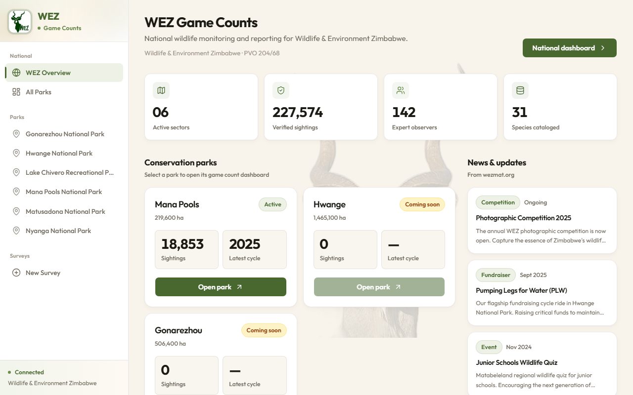
We built WEZ Game Counts as a modern Web GIS and reporting portal. The homepage surfaces national KPIs at a glance: active sectors, cumulative verified sightings, registered expert observers, and catalogued species. Each conservation park opens a dedicated dashboard with area coverage, sighting totals, and latest survey cycle information.
Key Features
- National overview dashboard — real-time summary metrics for leadership and communications
- Park-level portals — flagship sectors live with park-specific analytics; expandable to additional parks
- Verified sightings pipeline — structured data entry and validation for field observations
- Species catalogue — central reference for identified fauna across survey programmes
- News & updates integration — links to WEZ community programmes and conservation campaigns
Technology Stack
Outcomes
WEZ now has a public-facing conservation technology platform that demonstrates national monitoring capability and supports data-driven wildlife management. The system is operational at wezgamecounts.com, with active sectors reporting and additional parks planned for rollout.
Conservation GIS Expertise
Wildlife monitoring is a specialised GIS domain — combining mobile field capture, spatial analytics, and stakeholder-friendly dashboards. Flotech's work with WEZ showcases how conservation NGOs and PVOs can modernise game count programmes without losing scientific rigour.
Building a conservation or wildlife GIS platform?
From game counts to protected-area management, Flotech delivers field-to-dashboard geospatial systems.
Talk to Our GIS Team View Live Site